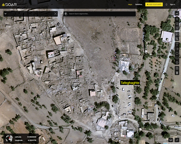
Amizmiz village was one of the most affected locations, in the mountains and at about 30km from the epicenter.About 2,000 people have died there, out of about 3,000 in the whole country. In the nearby small rural village of Tafeghaghte (image below, 9th September 2023) most of the houses were destroyed, and about 90 people died, about half of its residents. You can browse it on
Soar:
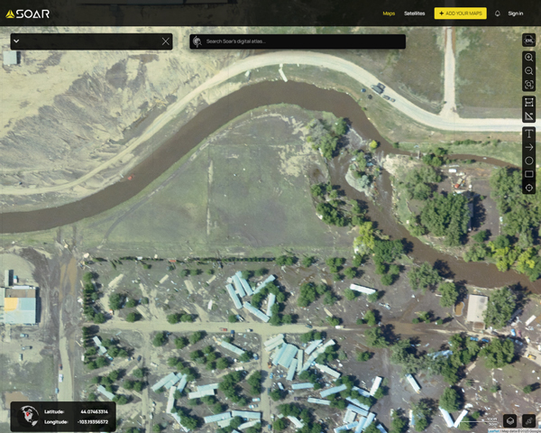
The Rapid City Flood happened in the night between 9th and 10th June, 1972. It was one of the deadliest and most destructive floods in U.S. history. It caused 238 deaths and destroyed about 1,335 homes and 5,000 automobiles. The economic cost was estimated to be nearly $1.12 billion in 2022 dollars. Aerial photography below, showing 11th June 1972, the first day after the flood. You can browse it on Soar here:
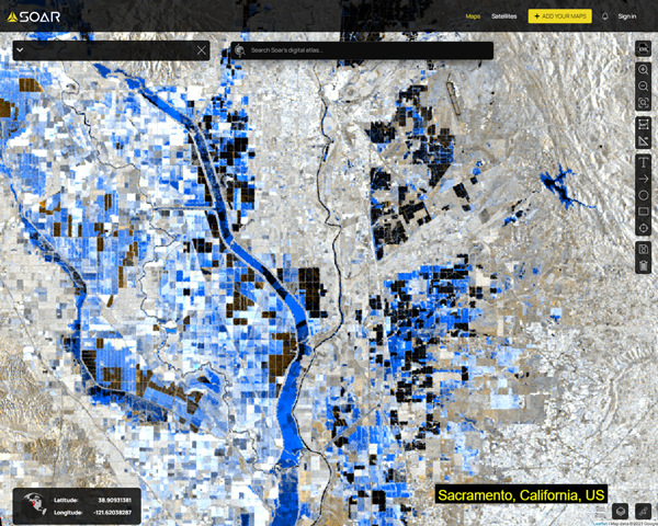
1972 aerial photographyWhile optical satellites usually can’t take pictures during floods, because the sky is usually too cloudy and they can’t see through clouds, radar satellites can do it, because they emit signals. Radar satellites are reliable resources to see through clouds. Here we can see the extent of the floods around Sacramento, California, which was then the hardest-hit county in the state. Radar image below, colored, 13th Jan 2023. You can browse it on
Soar.