
As Seen On:


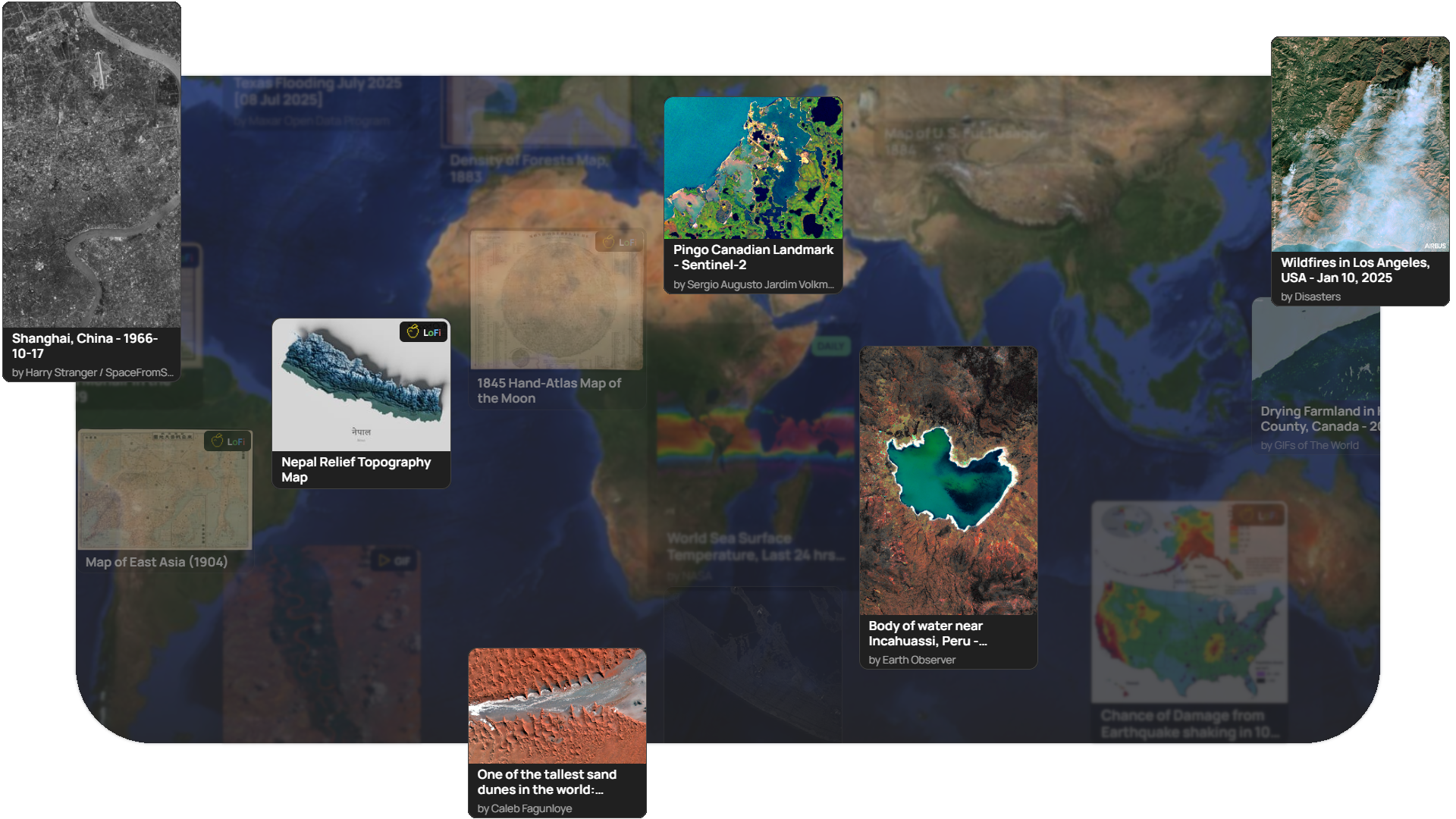
Soar is building an atlas of the world–a living, global library of humanity’s maps and satellite imagery. It exists to power everything maps make possible.
We don’t create, buy, or process this data ourselves; instead, we act as its steward and its home, bringing together some of the most extraordinary views of our planet ever captured.
From NASA and EU governments to libraries, public agencies, and individuals around the world, Soar is where these perspectives converge. Preserved, shared, and made accessible for everyone.

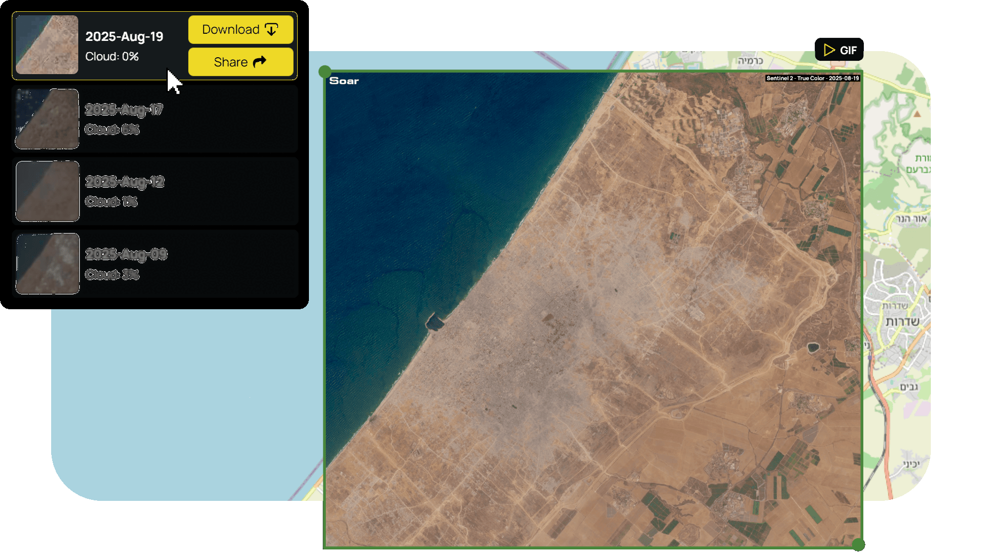
Access free satellite imagery from the European Space Agency and NASA anywhere in the world, including historical data going back over a decade.
Quickly create GIF timelapses for your stories showing changes over time, with a simple, intuitive interface that removes the complexity of traditional satellite software.
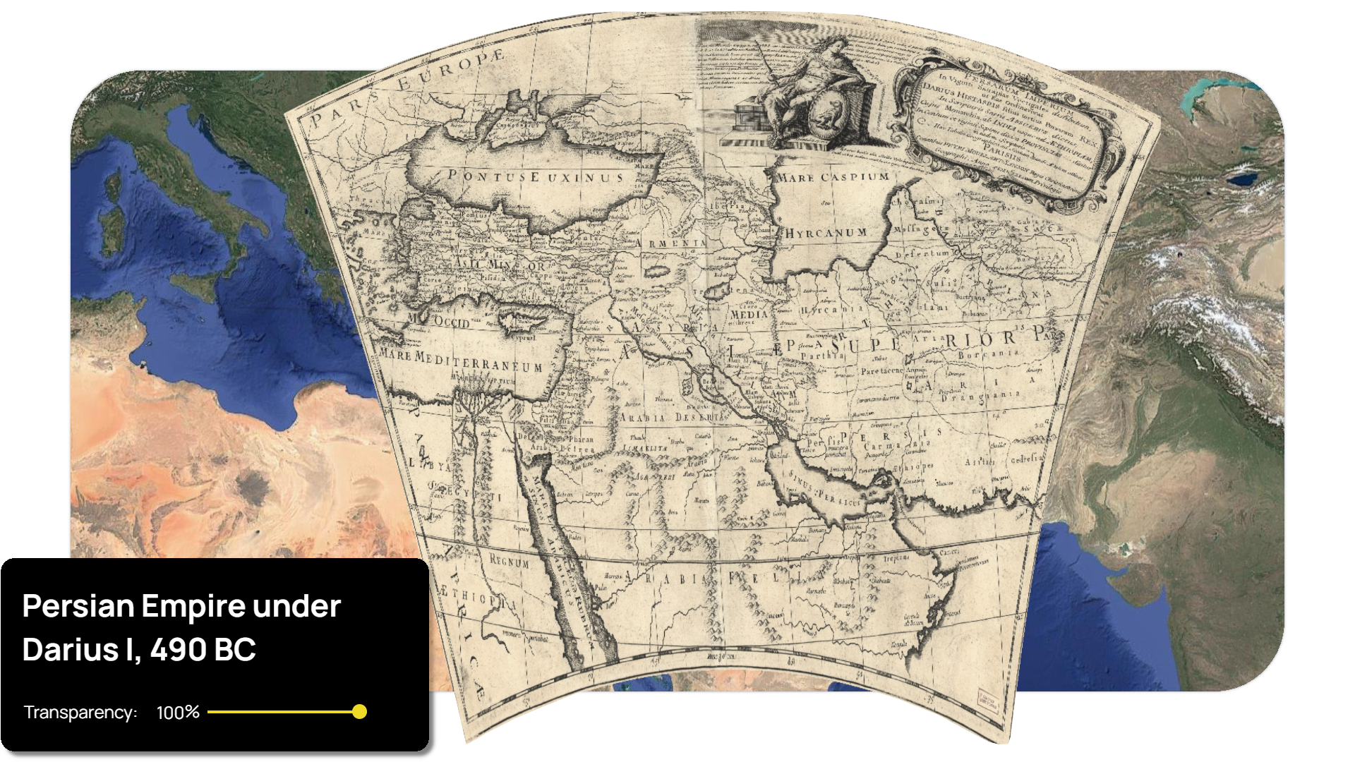
Soar’s ever-growing library of digital maps is easily searchable and steadily expanding to cover every corner of the planet. All maps and satellite imagery on Soar are free to use, with simple Creative Commons 4.0 licencing.
Simply credit the maps creator or imagery provider (via the description) with 'Soar Atlas', 'Via Soar Atlas' or 'soaratlas.com' when sourcing.
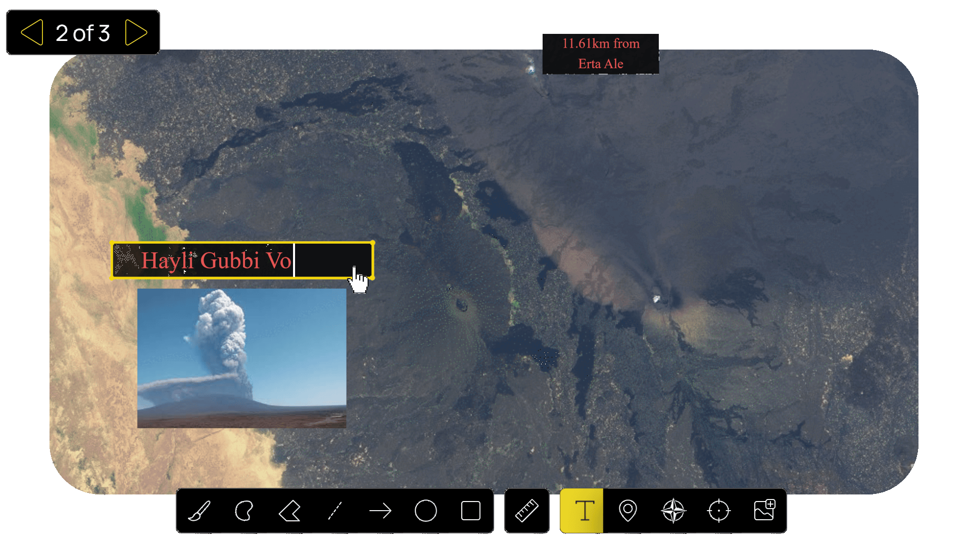
Bring your maps together using Soar’s intuitive presentation tools. Annotate any map or satellite image with measurements, text and photo overlays to create engaging, page-by-page stories your audience can explore.
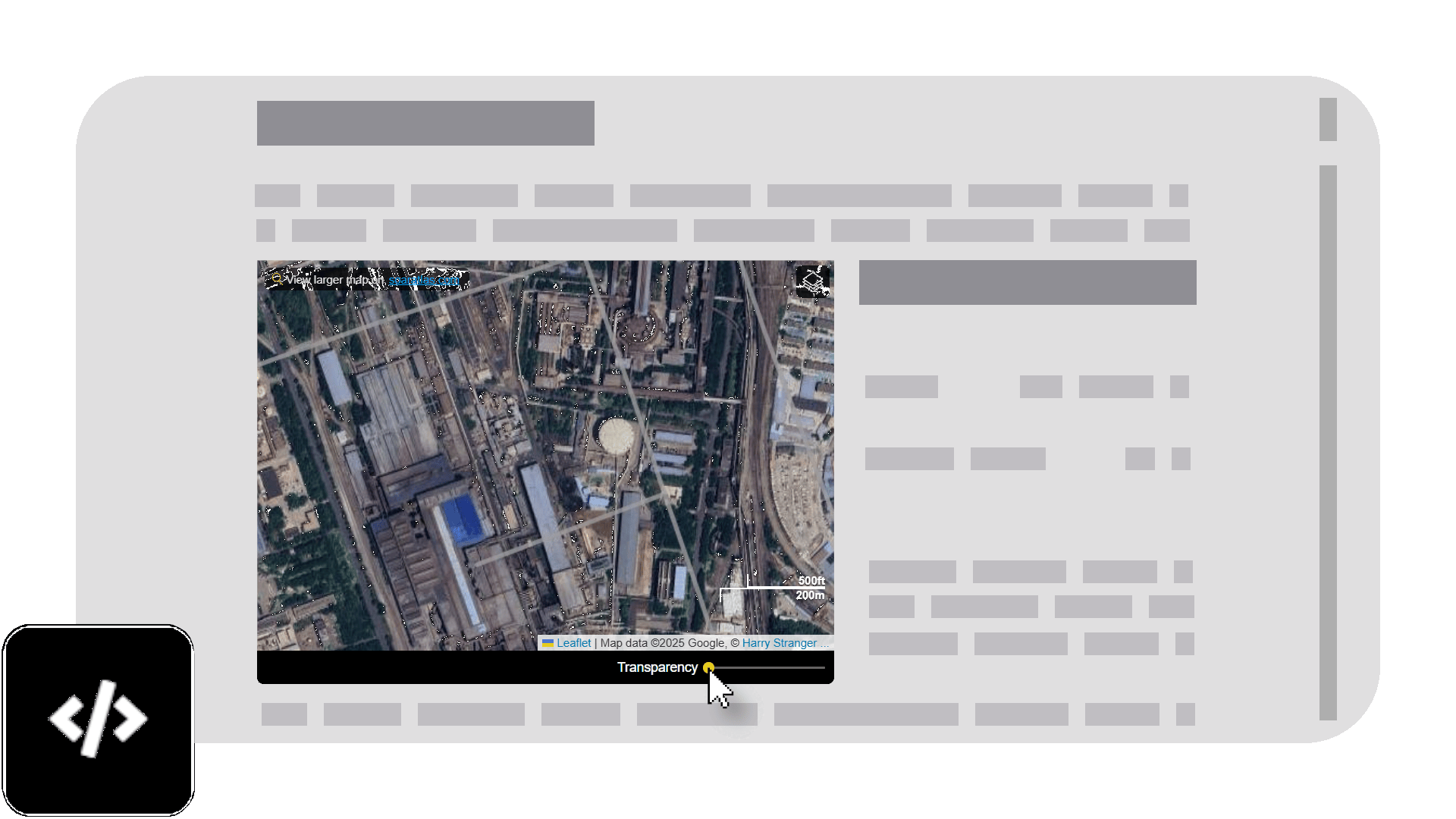
Embed any map directly into your articles, giving readers a dynamic map viewer. Let your audience explore and compare imagery without ever having to leave your website. Just visit a map > Click 'Share' > Click the Embed icon > Copy the code into your site!
Can't find what you need? Reach out to us and one of our team members will assist with getting imagery for your story, free of charge! We're here to bring your articles to the next level. Need help with the platform?
We provide:
✓ 1-on-1 walkthroughs to get you comfortable
✓ Ongoing platform support for questions and how-tos
✓ Connect with our content team to source maps to enhance your stories.
Add Soar to your workflow. Here are some resources to get you started.