July XXXXXXXXXXXXXX, 2025

With now over 1 million maps uploaded to Soar, it’s easier than ever to find exactly what you need, whether you're researching climate change, tracking urban growth, or just admiring the natural beauty of a remote location.
But what if you could do more than just explore? What if you could use those maps and build your own to tell stories, explain events, or bring data to life?Now you can, with our new feature we call Stoaries. With Stoaries, anyone can craft compelling, visual narratives using interactive maps. Think of it like a map-based PowerPoint, letting you annotate, add text, and even create slides, all on Soar.
The Battle of Khorramshahar Stoary on Soar
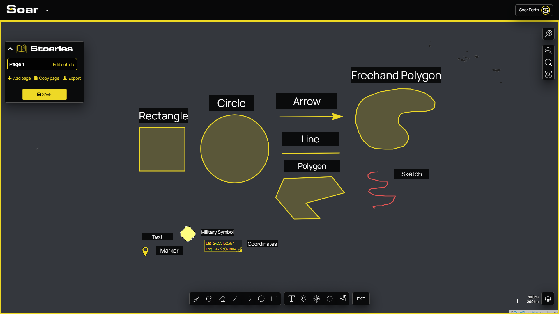
Getting started is simple. Just click “Create a Map” at the bottom of your screen. From there, you’ll enter the Stoary builder where you can:
- Add text, images, annotations, and even GIFs directly onto the map.
- Create multi-slide narratives that guide viewers through a sequence of locations, info, or moments in time.
This is perfect for sharing detailed information that’s hard to explain on social media without cluttered graphics or complicated formats. Now, you can simply share one interactive, zoomable link, letting your audience explore the maps clearly, intuitively, and the way they were meant to be seen.
Explore some great examples of Stoaries by our community below, some such as Disaster Mapping, which update constantly with new info each time you check in!
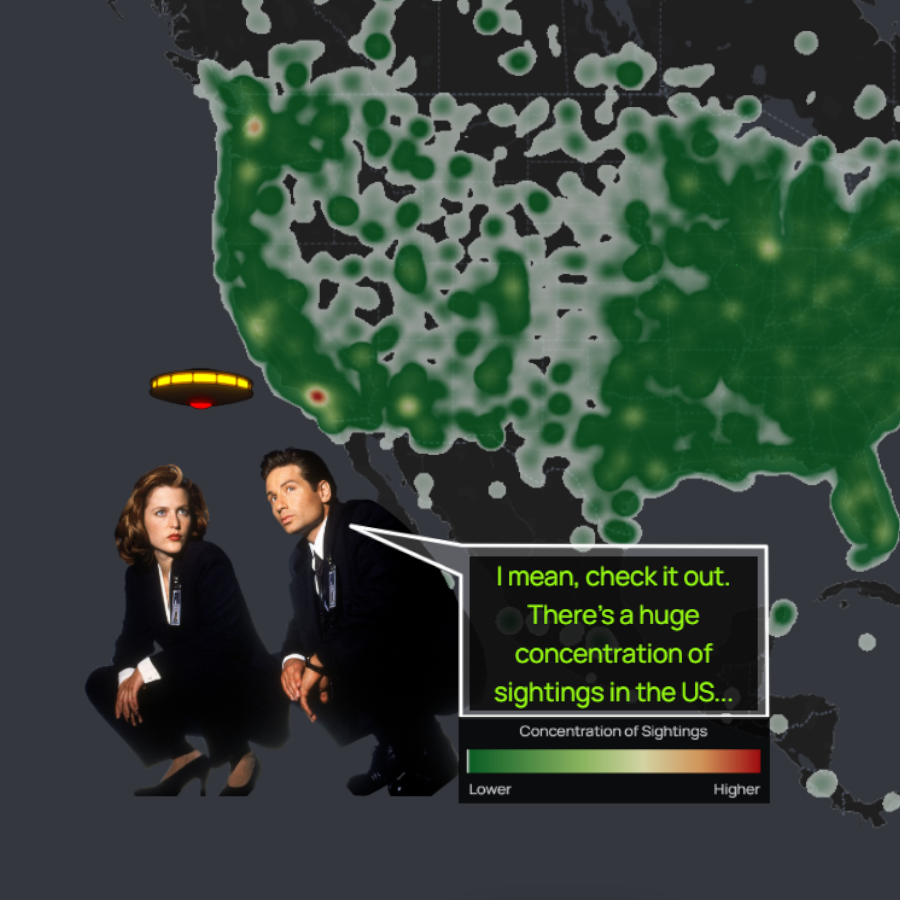
World Map of UFO Sightings (Left) The Travels of Marco Polo 1271-1295 (Right)
The Line Updates (Left) Disaster Mapping (Right)
Why We Built Stoaries
It’s simple! We built Stoaries because people needed a better way to go deeper with their maps. A single social media post often couldn’t do justice to the topic. It lacked the interactivity, and clarity needed to truly explore a place or idea.Journalists have already started using Stoaries to report ongoing news in an interactive format. Educators are designing class materials that keep students engaged. And everyday users are creating Stoaries about hiking trails, personal travel, cultural history, and so much more. We hope people continue to use the tool to share parts of themselves and their discoveries online.
Tools you can use inside a Stoary
Try It For Yourself
Ready to create your first Stoary? It’s completely free, and all you need is an idea.You don’t need to be a cartographer, a graphic designer, or a GIS expert. If you’ve ever made a slideshow, you’re already halfway there. Need help? Check out our short tutorial video below to walk you through the basics.
Just like Power-Point, Stoaries is changing the way we show information of maps. Whether you’re teaching, reporting, or simply sharing what matters to you, think of Stoaries as your canvas. It's time to share your Stoary.

This blog was written by:
Michael Pearce
Michael is a creative producer for Soar, crafting creative content such as videos, graphics, and social media posts. He has a background in video game development and enjoys spending time with pigeons in the city.