Using night-time imagery from NASA’s Suomi satellite sensor, and the power of Soar, we’ve discovered some patterns that may give us an interesting perspective on the economic activity in Ukraine since the Russian invasion. Let’s take a look!
Before the invasion of Ukraine by Russia, sustained economic activity in the form of night time lights can be seen in the region clearly showing heavily populated cities of Moscow, Minsk, and Kyiv. Multiple smaller light clusters of smaller cities and towns across regional Ukraine are clearly visible.
Almost one month after the start of the conflict, there is significant darkening of night time lights across Ukraine. No visible difference across the borders of Russia and Belarus as a comparison. Regional areas of Ukraine have seen significant decreases of night time lights in particular as the eastern parts of Ukraine, especially around Kharkiv.
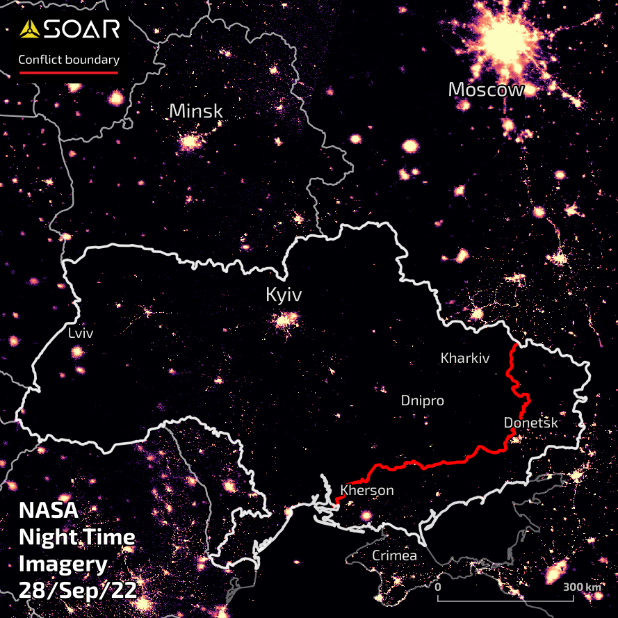
By late September, 2022, the Ukrainian armed forces have successfully repealed invasion in northern and eastern areas areas. Significant increase of night time lights around Kyiv is visible. Although most of the newly liberated eastern areas are still dark, central regional areas of Ukraine are seeing a slight increase in night time lights.
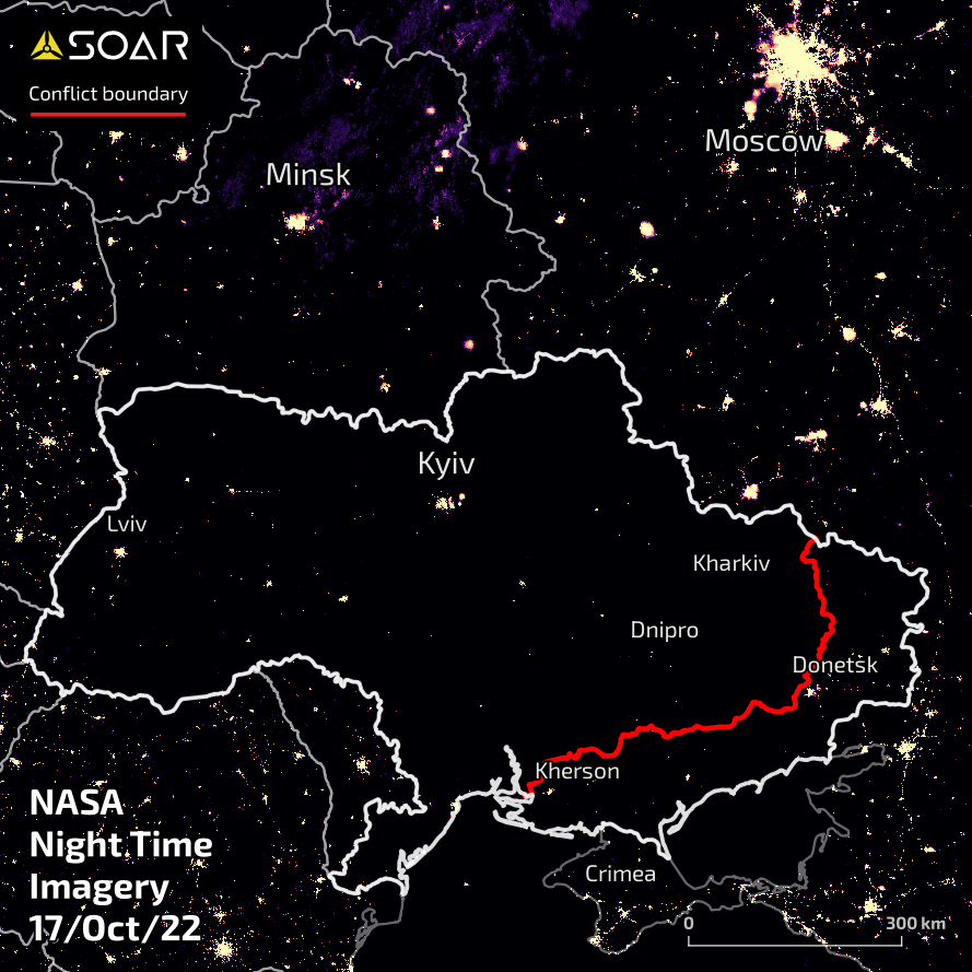
Most recent clear image observed by Soar shows a scene very similar to the one taken in March 1 month after the conflict started. Although the Russian forces have been pushed back to almost their initial invasion gains in the southeast, there appears to be a lack of significant increase of night time lights across broader Ukraine: mostly likely due to sustained strikes by Russian forces targeting electrical and other infrastructure establishments.
To view more maps around Ukraine, hop on over to
Soar and zoom into
Ukraine. We have many amazing mappers who upload new content every day.