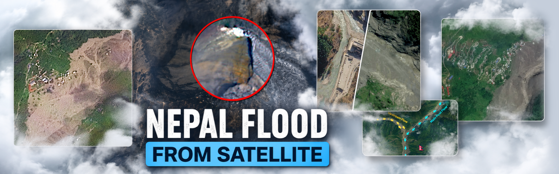

A devastating flash flood struck the Nepal-Tibet border on the 26th of August 2026, leaving a trail of destruction across the mountainous region. Satellite imagery gives us a unique way to breakdown what happened during this devastating event.
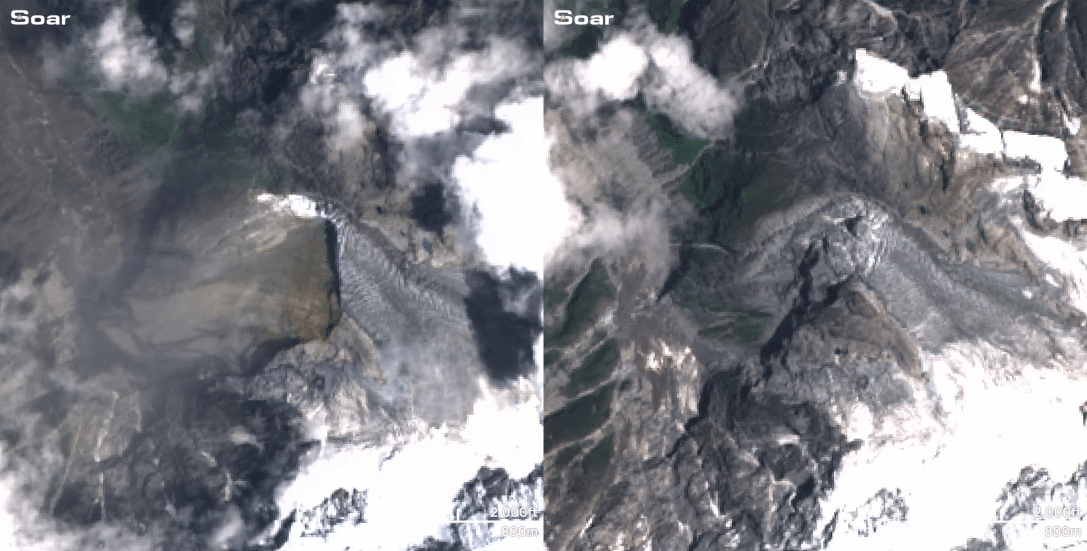
First, we must look high in the Himalayas at this mountain, Langtang Lirung. It's believed that a giant glacier on the mountain collapsed, sending an enormous amount of ice and debris down the steep slopes below.
This is the highest mountain in the Langtang Himal range, rising around 7,234 metres above sea level. Due to its extreme height and harsh conditions, pockets of glaciers form around the upper parts of the mountain and remain frozen for much of the year.
Under this ice is rock, which over time can become unstable, causing a sudden collapse. Looking at satellite imagery from the day after the event, we can clearly see a massive section of ice missing.
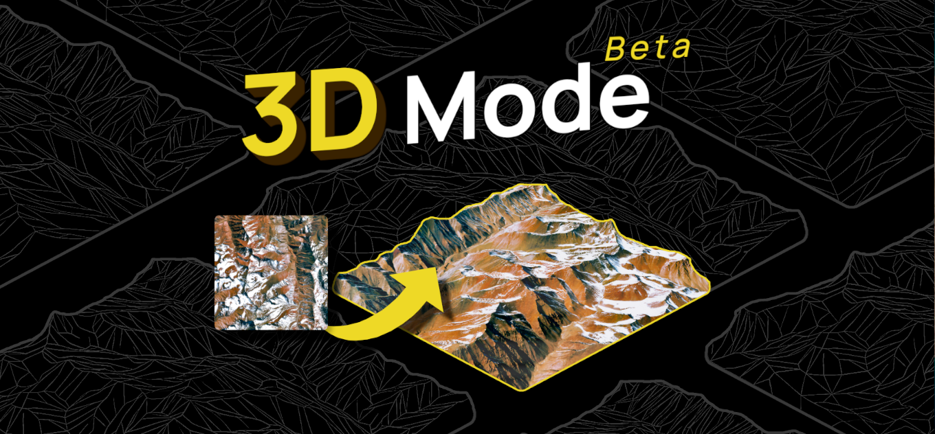
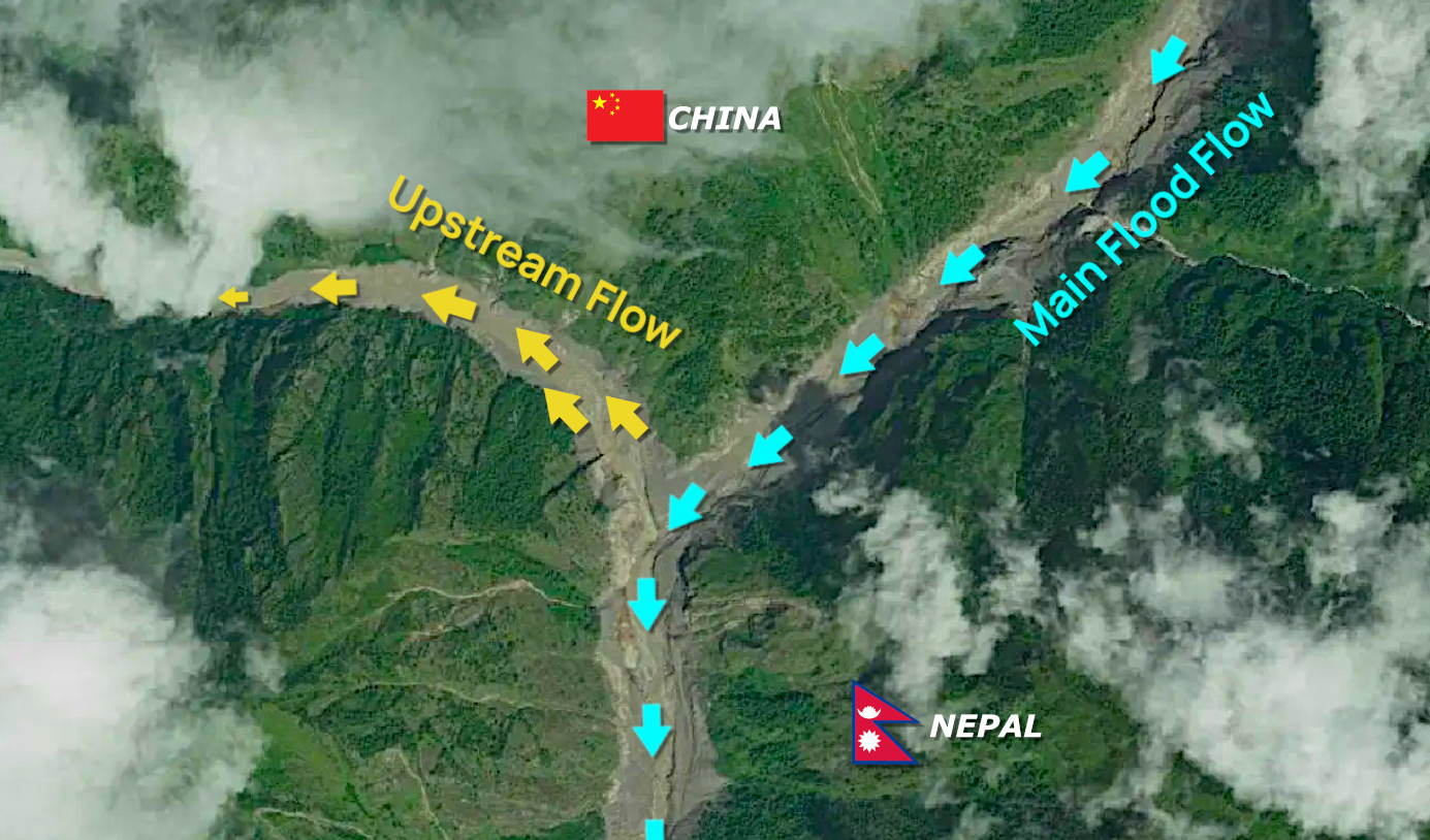
The glacier collapse triggered a devastating flow of water, rock, mud and debris that travelled rapidly down the valley, eventually reaching Gyirong Port. In 3D Mode on Soar, we can visualise the surrounding mountains in much greater detail and understand how the shape of the valley helped channel and guide this powerful flow directly towards Gyirong Port.
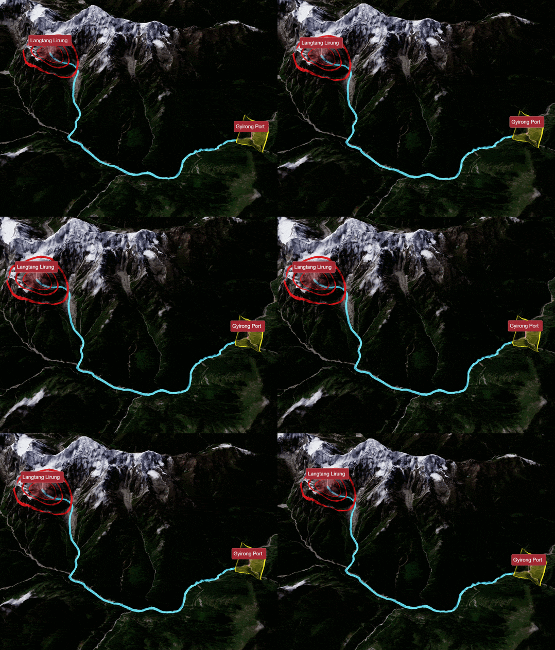
This port was the first major area to be hit by the flood, with dramatic CCTV footage quickly spreading online, showing a huge wall of debris moving through the crossing.
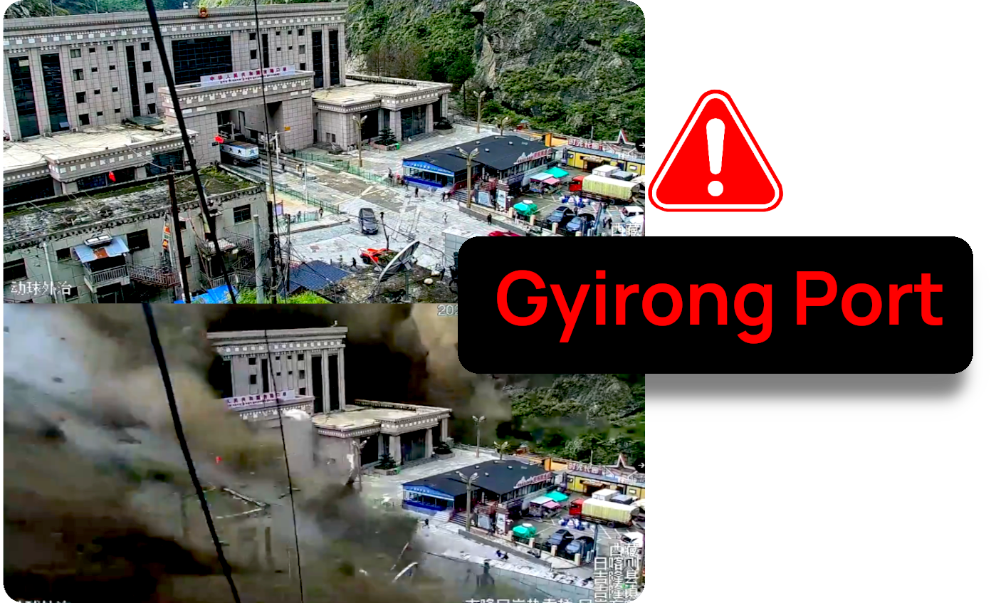
One reason the event was so destructive was the compounding effects it created as it moved downhill. As the ice and rock collapsed, the force melted the ice, making it into a slippery slurry. As it suddenly rushed down the mountain, enormous amounts of material were picked up and incorporated into the flow, creating a powerful mixture that grew increasingly dangerous as it travelled.
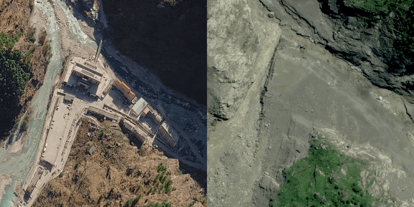
New emergency satellite imagery from sources such as Planet and Vantor gives us a much clearer view of the aftermath. Gyirong Port being the first major area hit, caused vehicles, infrastructure and buildings to be swept away by the immense force of the flood. What remains is a landscape dramatically transformed, with large areas of exposed rock, where roads, buildings and other infrastructure once stood. This shocking before-and-after comparison shows how much destruction the area experienced. Put simply, Gyirong Port is gone.
The force of this flood was so powerful that it pushed its way uphill for around 2.5 kilometres, spreading out from the fork in the valley where it first hit Gyirong Port.
Of course, the effects of this collapse travelled far beyond Gyirong Port and deep into the surrounding valleys, affecting communities and infrastructure in areas including Timure, Syapru Besi and Betrawoti Bazaar.
Satellite imagery from Timure show several clusters of buildings appear to have been washed away by the powerful floodwaters.
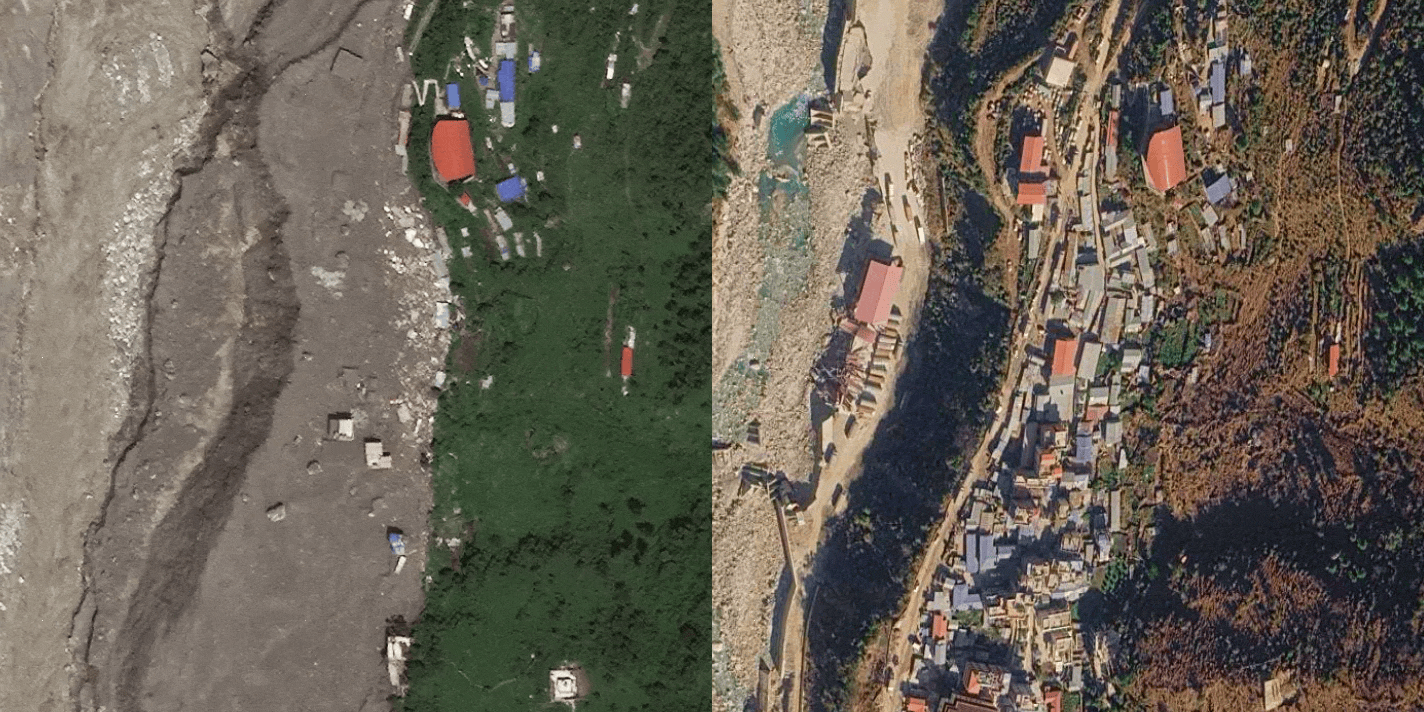
The flooding also tore through the mountainous area near Syapru Besi, where a town was hit by a powerful surge of water and debris, burying multiple buildings along the flood’s path.
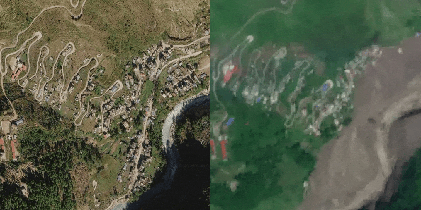
At Betrawoti Bazaar, the flood measured over 530 metres wide, encompassing structures and areas of development spread along the valley as the enormous flow moved through the landscape.
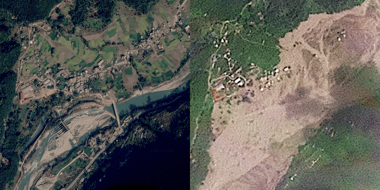
The floods travelled for more than 20 kilometres from the initial collapse, following the steep mountain valleys and river systems before spreading across communities further downstream. The disaster has so far claimed at least 392 lives, with 1,468 people still reported missing across Nepal and Tibet as rescue teams continue searching through the affected areas.
The devastation will be felt by these communities for a long time to come, with homes and critical infrastructure destroyed across the region. As rescue and recovery efforts continue, our hearts go out to the families and communities affected by this tragic disaster.
While events like this are shocking and can seem impossible to prevent, there are ways governments, scientists and communities can monitor the risks and improve their understanding of these potentially dangerous areas. While we cannot stop a glacier from collapsing, better monitoring and early-warning systems can help us understand where risks are increasing and potentially give people more time to respond.
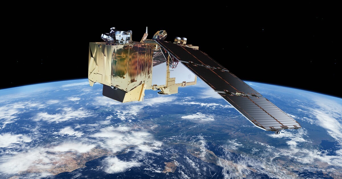
Satellite imagery is one of the most powerful tools available for monitoring these changes. Regularly monitoring glaciers can help scientists identify areas that are changing over time and potentially highlight warning signs before a major event occurs. Radar satellites can also detect subtle movements of the ground that may indicate increasing instability, even when those changes are difficult to see with the naked eye.
Amir Farhand, CEO of Soar Atlas and a geomorphologist, says these events are a natural and unavoidable part of how the Earth’s surface changes:
“As a geomorphologist, I would say these mass-movement events are sadly unavoidable. They are an important part of exogenic surface processes and are completely natural. However—and this is a big however—with all the incredible tools we have at our disposal, these events should be easier to predict, but most importantly, to measure. SAR interferometry, for example, could have measured this movement down to the millimetre.”
Initial reports suggested that the flood may have been caused by an earthquake, but satellite imagery gave us another way to investigate and identify the source of the flood. By comparing imagery from before and after the event, people saw the missing section of ice on the mountain and begin to connect that change.
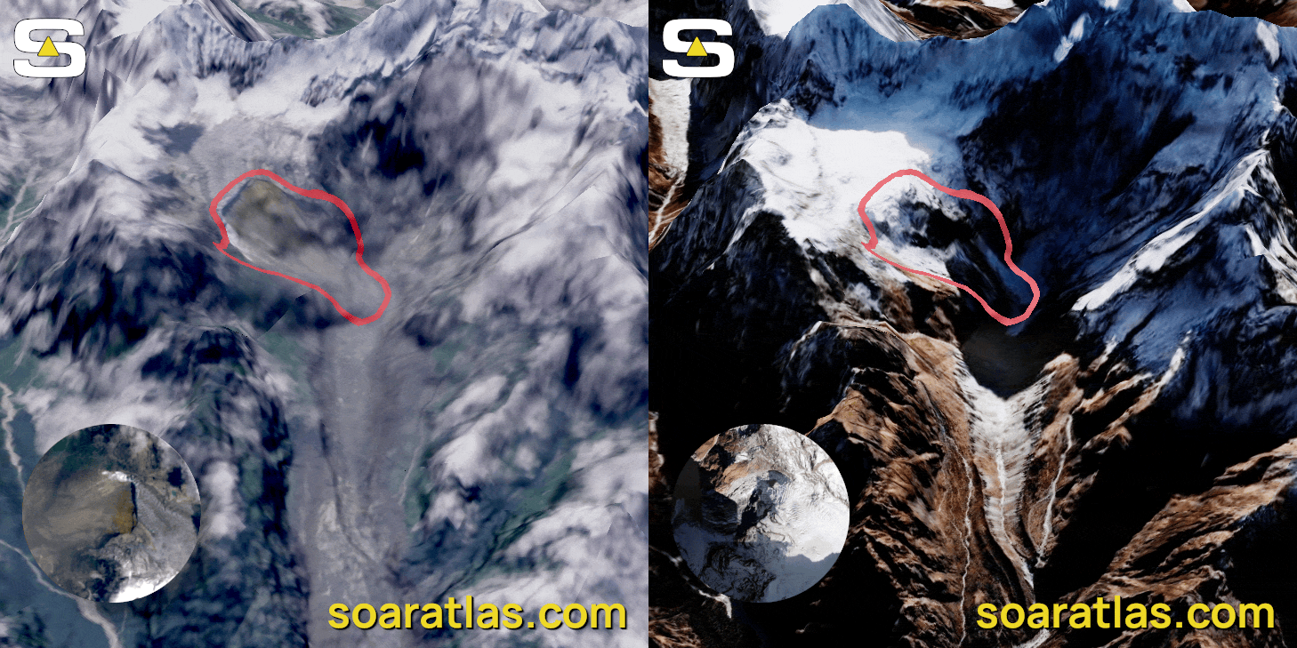
Before-and-after imagery is incredibly important for events like this because it allows us to see changes that can otherwise be difficult to understand from ground-level footage alone. As the community continues its work to analyse, assist and understand more about the event, free tools like Soar help put the power of satellite imagery and mapping into people's hands, allowing anyone to explore these events and better understand what is happening across our world.