
Welcome to another Map Mail 📫 mappers! 👋 We hope you're all safe and well. It's been a busy month, so let’s jump straight in.

Our CEO Amir Farhand, recently spoke with the BBC alongside other industry experts about a growing concern in the world of satellite imagery: The implications of AI-generated fakes, as well the increasing satellite restrictions over conflict zones.
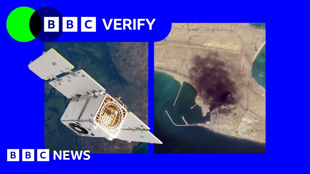
Read the BBC News Article here 👈
At a time where misinformation is spreading rapidly online, ensuring public access to trustworthy geospatial data has never been more important to us. We hope Soar continues to serve as a trusted place to explore, compare, and understand events unfolding across our planet each day.
We’ve continued working closely with OSINT contributors and media partners to map developments related to the Iran conflict, using the latest available satellite imagery and information. Below are some recent maps that help illustrate key events on the ground. Visit any by clicking them.
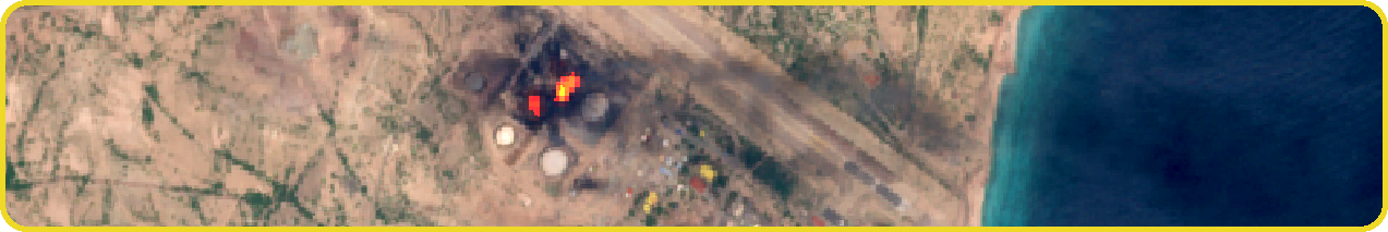
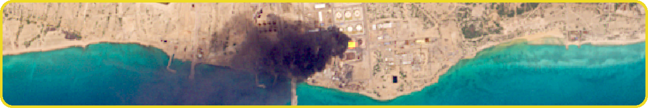
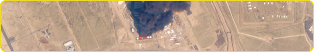
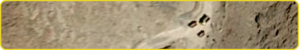
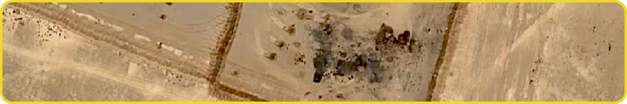
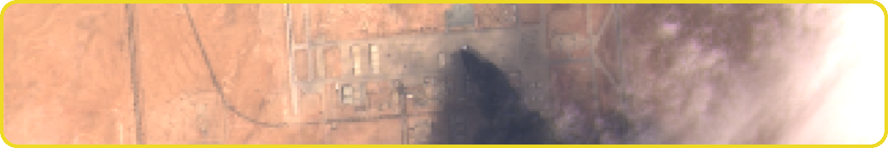
Explore more Iran Conflict maps here 👈
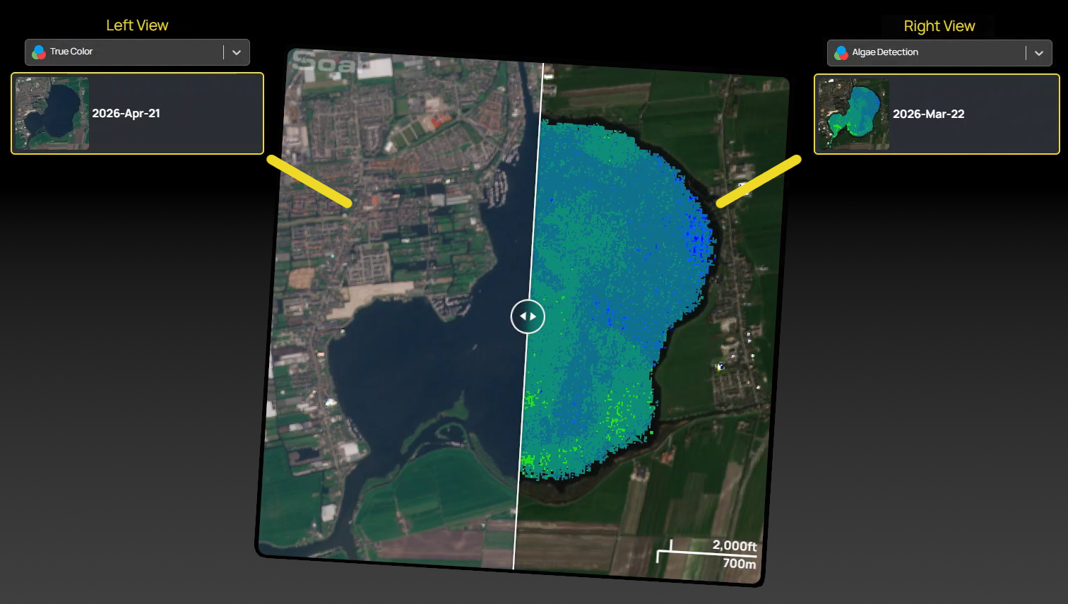
We’ve added a fun but important new way to explore satellite imagery, with the new "Compare" button. You can select two satellite images within your search area and view them with a slider to analyse change over time.

This isn’t just limited to time-based comparisons! You can also compare different image filters against each other, making it especially useful for tracking vegetation shifts, water level changes, fire activity, and more. Over 10 years of satellite imagery is waiting for you to explore, compare, and analyse, right inside Soar.
We’ll continue expanding the satellite tools to support investigative workflows and real-world monitoring. Try it out and see what you discover!
Try the new Compare button here 👈
If you frequently monitor a specific location, you can now save your search area, give it a name, and return to it instantly anytime. No need to redraw your AOI, just click and pick up where you left off.
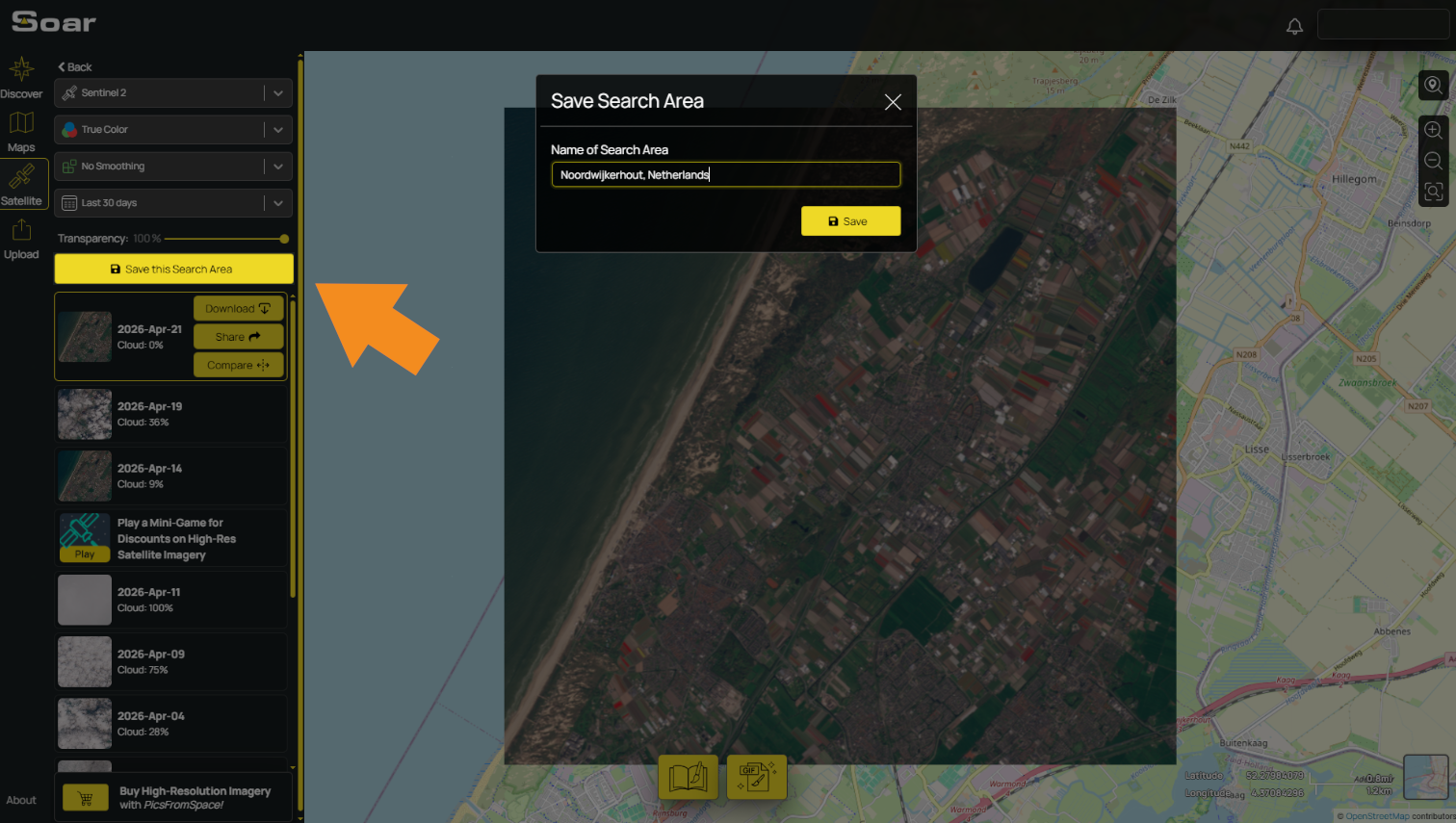
This is especially useful for investigations, change detection, and monitoring how an area evolves over time. You'll see your growing list of saved searches in the satellite tab which you can also edit and delete as you need.
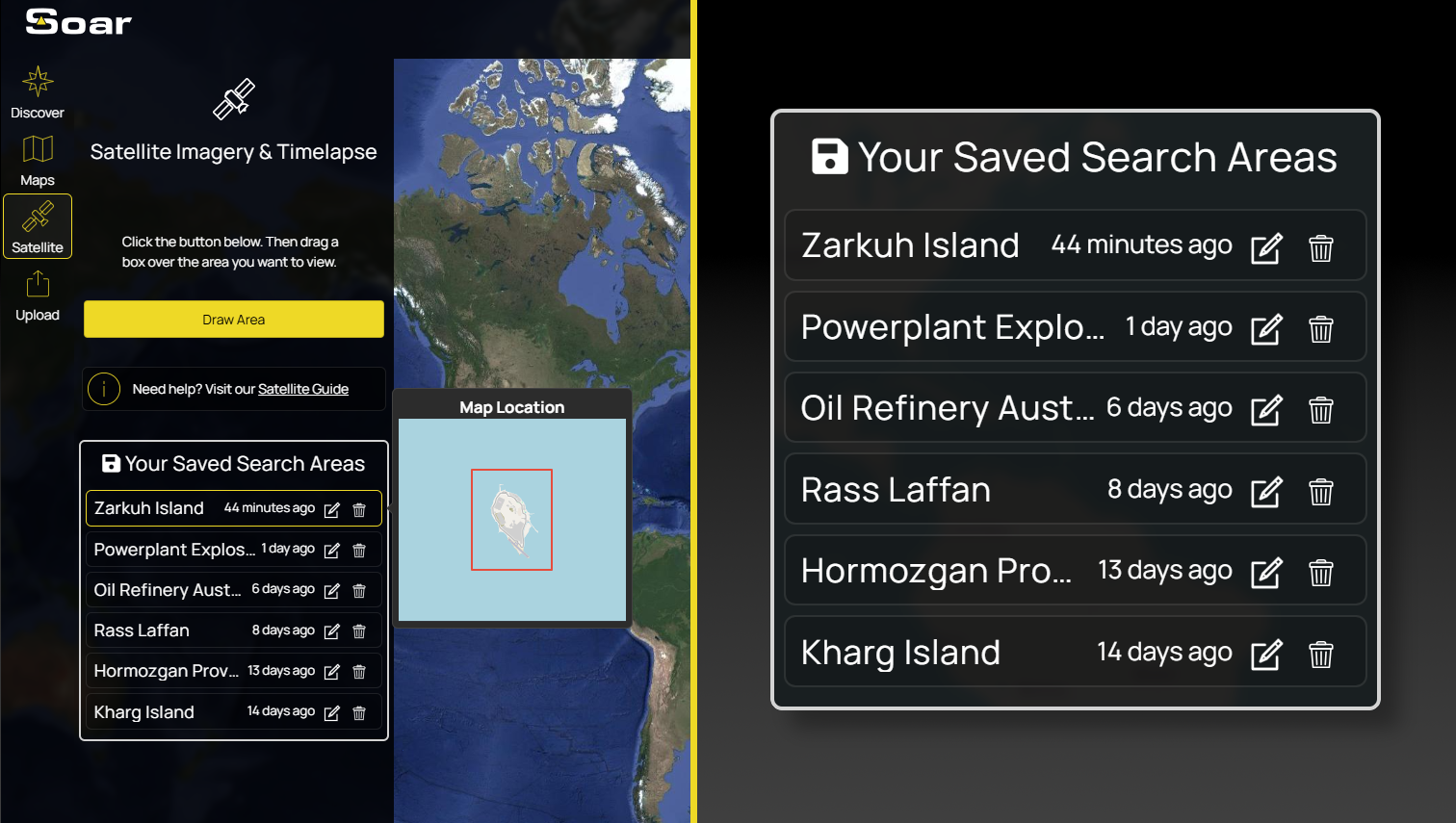
Some of our users have already been using it to track developing situations in the Iran conflict, saving key areas that are likely targets. Give it a try!
That’s all for this edition of Map Mail. We’ll keep building tools that help people explore, understand, and investigate our changing planet. Thanks for reading!