
The unprecedented situation in the Middle East has the world watching. Accurate, verified information has never been more critical, and maps have become an essential tool for understanding events as they unfold. Over the past week, the Soar community has been documenting affected areas and releasing new content. As the conflict evolves, we hope Soar can shed light on these complex and urgent events, putting the power of maps directly into people’s hands. Our goal is to be a neutral, trusted platform everyone can rely on for accurate information.

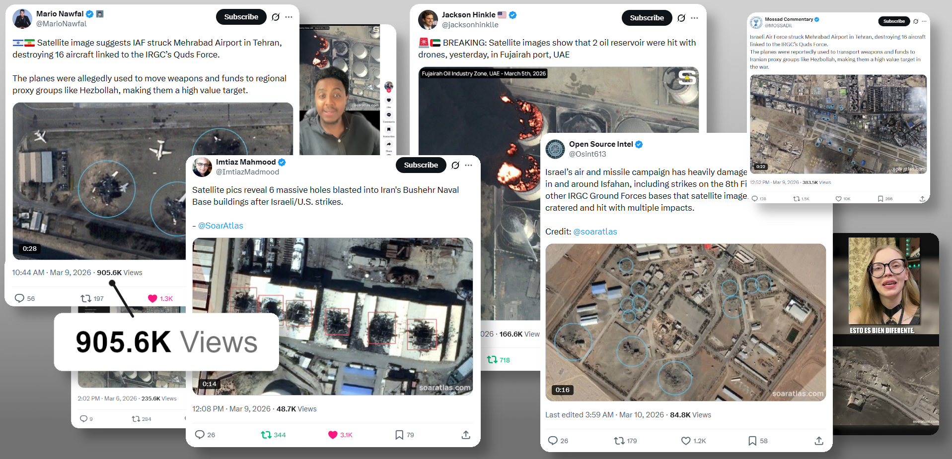
Imagery from major providers has been arriving rapidly, and our community has been georeferencing these images to map them to their real-world locations, enabling people to compare and analyze events. Short videos showcasing findings using our annotation tools have been widely shared across social media, raising awareness of key developments. We will continue to release maps and investigative videos in real time as new information becomes available.
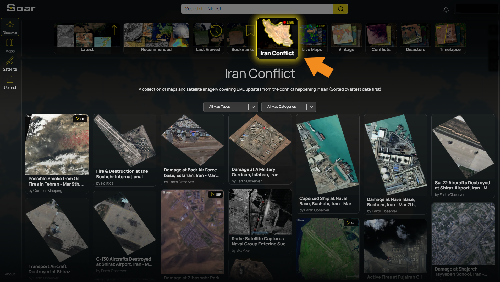
High-resolution satellite imagery of different areas such as Bushehr International Airport in Iran have been added to the platform. This map shows a large plume of black smoke alongside damaged buildings and multiple impact craters.

Something notable in the Tabriz Missile Base imagery is a large dust cloud from a very recent impact. This suggests the strike occurred just moments before the satellite passed overhead.

These maps, and many more on Soar, capture critical moments in this conflict, helping everyday people see the scale of events as they unfold.
We’ve been working closely with the press to support investigations, and our community’s imagery has received global coverage. We’re grateful to the journalists and investigators worldwide who are delivering real-time, verified information to the public.

If you’re looking to cover developments, have a mapping request, or want to collaborate with us, please get in touch.
Soar features built-in annotation tools that anyone can use on any map. We’ve put together a short video demonstrating how the community is actively using these tools to track and document developments of the conflict in real time.
Due to the rapidly unfolding events, we’ve launched a new Bundle on the Soar homepage that brings together key maps from Iran, organized by date. We hope it makes accessing the latest maps as new information comes in quick and easy.
That’s all for today. During this difficult time, our thoughts are with everyone affected by these conflicts. At Soar, we continue to believe that accurate information and open access to maps can help people better understand events as they unfold, and we remain hopeful for peace.
Thank you for reading this edition of Map Mail 👋