
Welcome to Map Mail 📫 mappers! 👋 This is our newsletter that typically goes out to our Soar users, but we'd like to start publishing these over here on our blogs too, so they're easy to look back on and discover! Let's dive into our first topic for todays Map Mail.

First, we’re excited to share we've been working on a Soar Creators Program! This is your chance to earn extra money by sharing your maps and growing your audience. Right now, we’re gathering feedback to shape how this program will work, and we’d love your input!
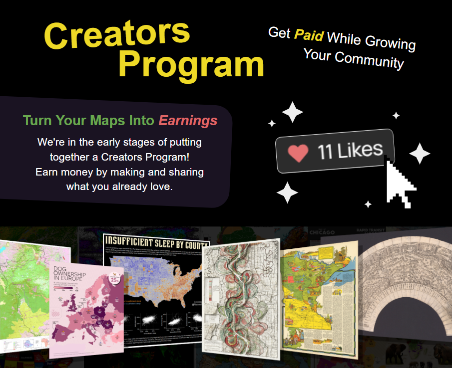
Fill out the Creators Program Form Here 👈
We’ll share more details soon, including a full break down of how it works and how to apply for the limited spots when it launches!
As we wrap up the year, we’re spending some time making Soar run smoother, faster, and better! You may have already noticed some improvements in responsiveness, like the home page loading faster. Our latest version of Soar dropped this week which includes some handy tools for exploring maps.
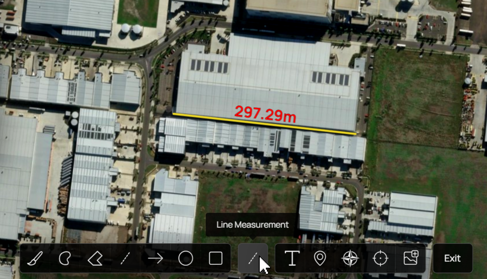
First up is the quick measurement tool, which lets you jump into any map and measure the distance from point A to point B. Previously, we had some measurement-capable tools, but this new one is the fastest way to access measurements without refining and toggling options on and off. It’s simple - just draw your line, and bam - it's measured! To access it, just visit any map > click ‘Make a map’ > then click the new quick measurement tool.
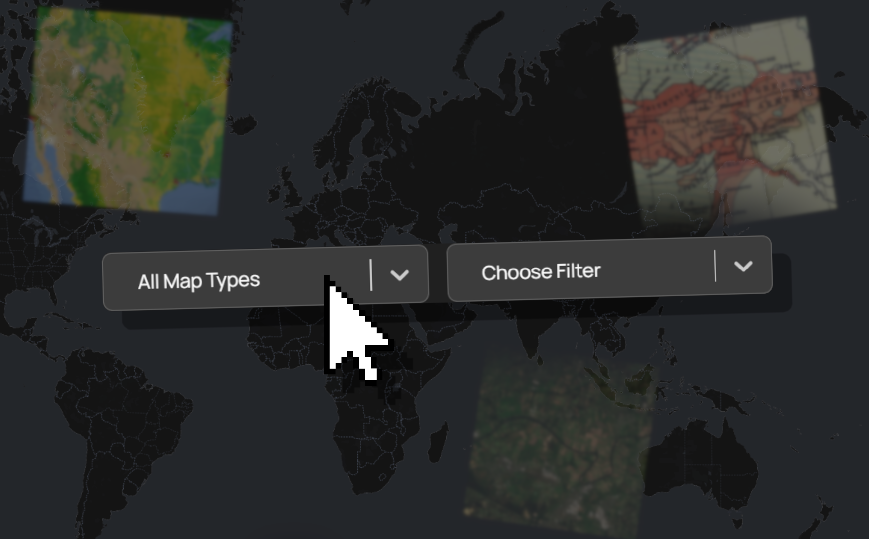
Next, we’ve added filters to every bundle on our Discover page, meaning you can now filter each individual bundle by map category and map type. It’s super handy for refining your search even further.
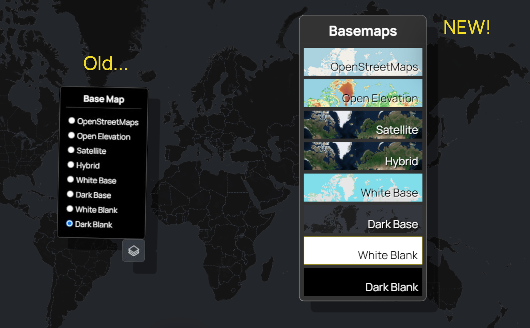
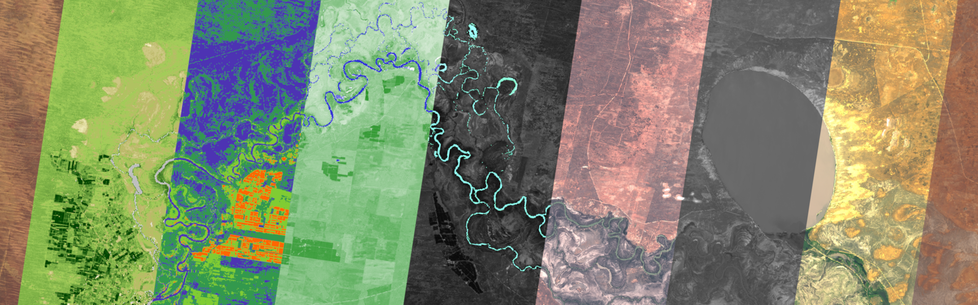
Finally, our basemap selector has received a bit of a visual refresh. It now shows a quick preview of what each basemap looks like. We're still gathering feedback and will adjust this new look over time to work best. For those of us who are more visual, we hope this makes swapping basemaps even easier!
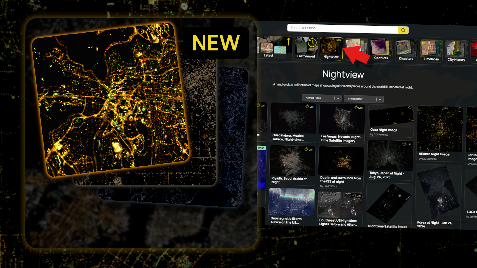
We’re also excited to show off a new bundle! This one focuses on night-time imagery, a tricky thing to capture for satellites, but the results are beautiful. Check it out!
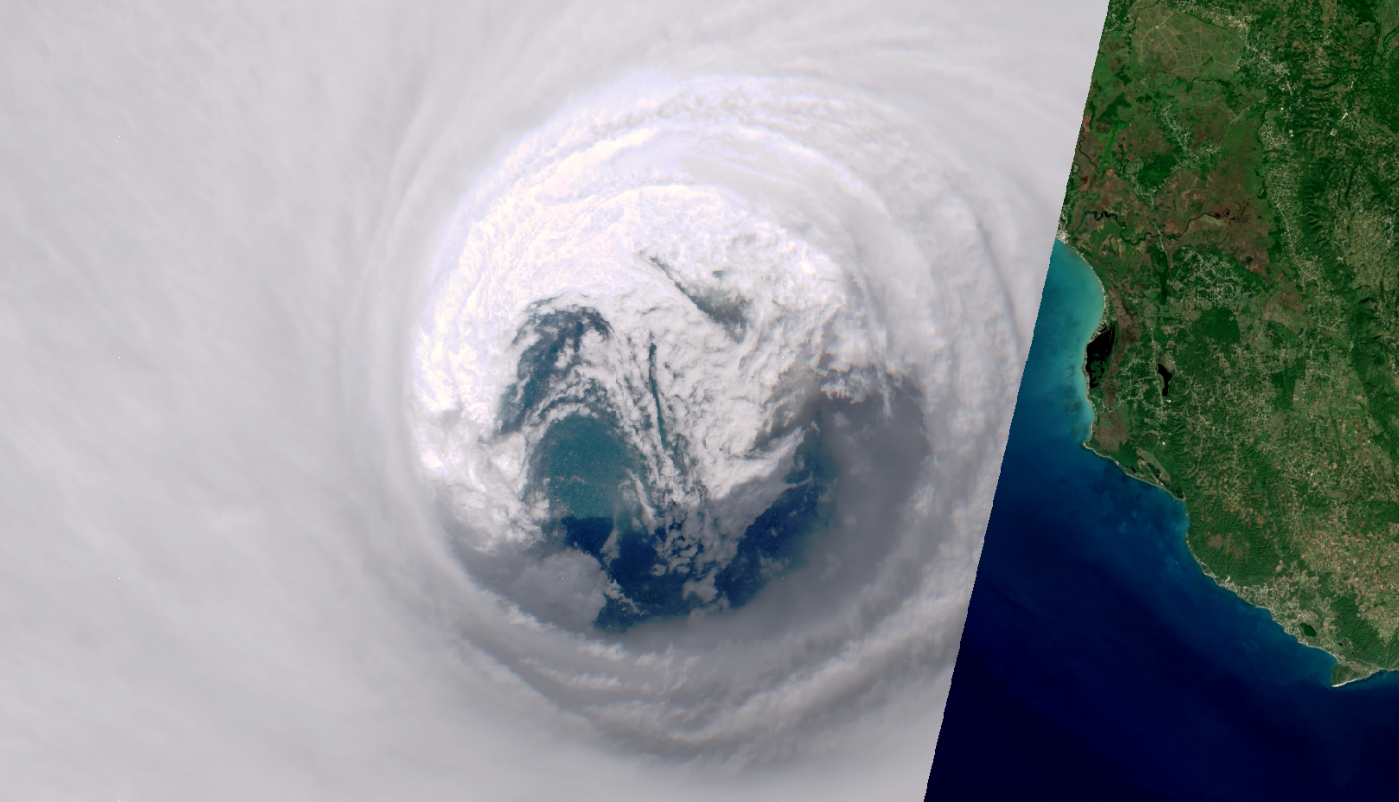
Recently, Hurricane Melissa struck Jamaica. Sentinel-2 managed to capture one of the clearest satellite views ever taken of a Category 5 hurricane, shown here at peak intensity, just 18 km off Black River, Jamaica.
We’ve added some stunning new satellite images from Vantor Open Data Program revealing the aftermath of this hurricane in Jamaica. The destruction is hard to comprehend, with entire coastlines reshaped and widespread flooding.
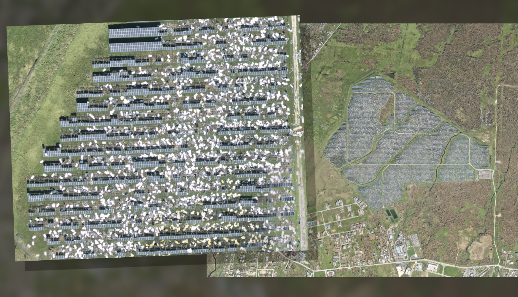
You can now explore the georeferenced maps on Soar and directly compare before-and-after yourself using the transparency slider. There's also tons of imagery to see on Vantors profile of the event.
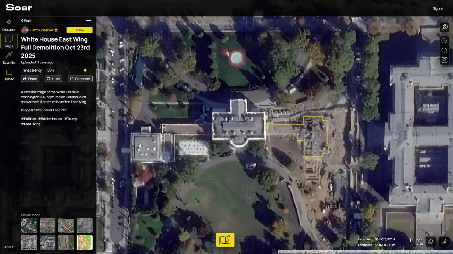
Using imagery from Planet, we’ve also georeferenced a new comparison showing the demolition of the White House East Wing. This historic and controversial event has sparked widespread discussion. Georeferencing these maps is an important way to see the real scale and impact of the changes in context.
A huge milestone for the Soar community! We want to give a very special shout out to one of our most dedicated contributors, Harry Stranger, who’s just uploaded his 1,000th map on Soar!
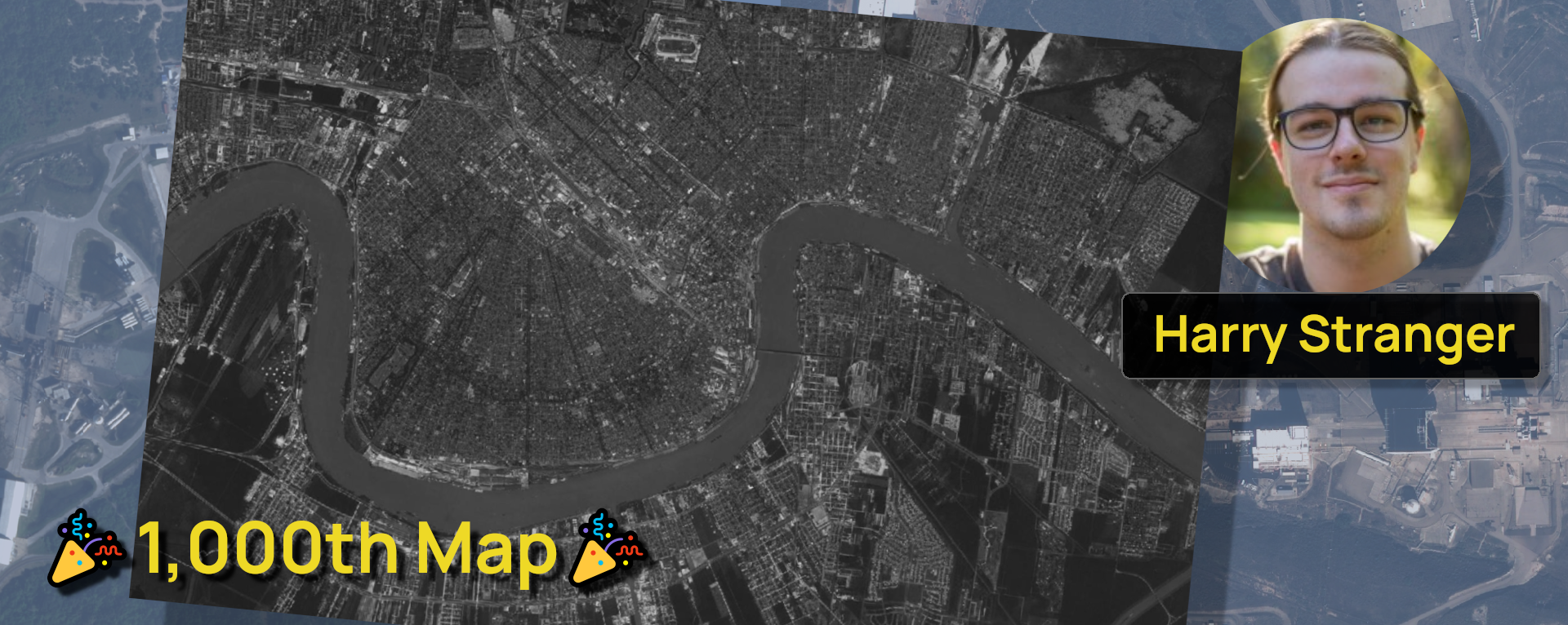
Harry is best known for his incredible archive of vintage satellite imagery, some dating as far back as the 1960s. His maps capture decades of change across regions, preserving history in an open and accessible way.
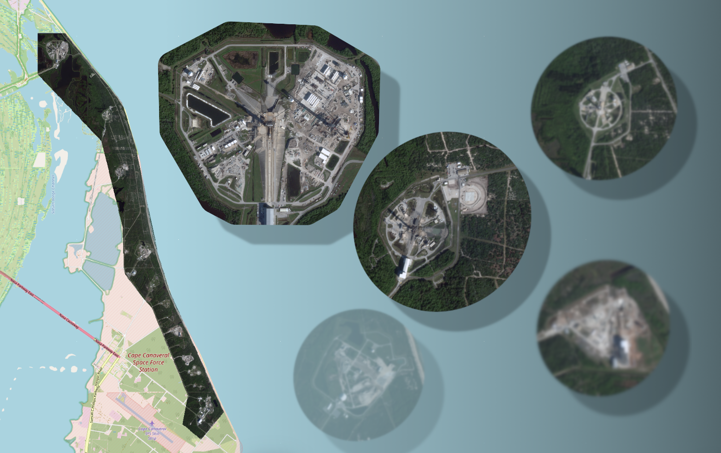
He’s also been a key figure in tracking global launch pads and SpaceX activity, sharing fresh satellite updates every few weeks. It’s passionate contributors like Harry who make Soar such a vibrant, community-driven platform.
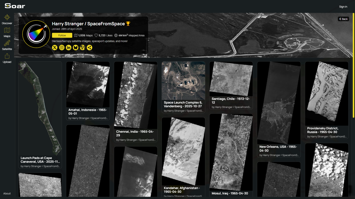
Please check out Harry’s profile on Soar and send some love his way by following his account on Soar. It only takes a second!
We’re excited to announce that today we’ve launched our Soar Blogs, designed to be your go-to place for tips, tutorials, and feature deep dives to help you get the most out of Soar.
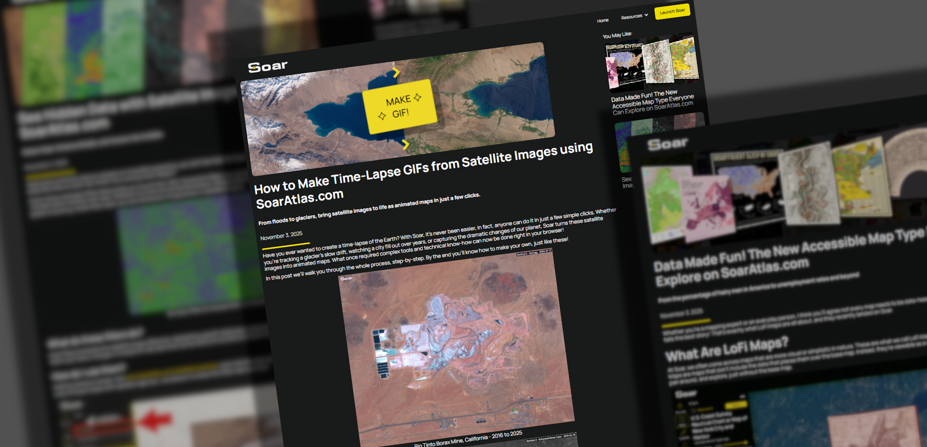
One of our ongoing challenges as a platform like Soar is how quickly it evolves (It's a good problem to have!) With frequent UI updates and ongoing feature improvements, tutorial videos can quickly become outdated. This can make learning Soar a bit confusing for new users.
To solve that, we’ve built our new blogs with flexibility in mind. Each post can now be easily updated as Soar continues to grow, so you’ll always be reading the most accurate info. Every blog includes a disclaimer at the bottom, showing which version of Soar it represents. We’ll be revisiting posts regularly to refresh screenshots, text, and examples to reflect the latest updates.
To kick things off, our first three new blogs cover: LoFi Maps, GIF Maps, and Satellite Filters. Whether you’re new to Soar or just want to explore some great examples, check them out on our Blog Page today!
That’s it for this Map Mail. The year is quickly heading to a close but we're not done quite yet. There's a lot on our list that we're excited to share soon so please stay tuned. Until then, enjoy exploring and thanks for reading this edition of Map Mail, mappers! 👋
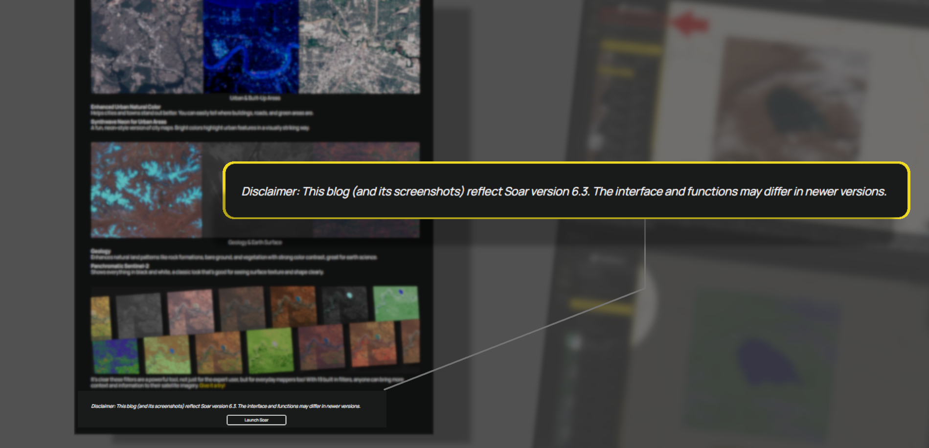
Disclaimer: This blog (and its screenshots) reflect Soar version 6.3. The interface and functions may differ in newer versions.